CalCo Surveyors Pty Ltd
Surveyors in Gloucester
- Range of Surveying Equipment
- Computer Aided Design Systems
- Serving Throughout the Mid North Coast
Residential, Commercial and Industrial
Serving Engineers, Architects, Homeowners & Construction Businesses
Land & Construction Surveying Solutions
Accurate Surveying for Smarter Projects
Getting precise land measurements is crucial for any project—whether you're a homeowner, developer or construction professional. At CalCo Surveyors, we bring over 35 years of expertise to ensure your site is mapped accurately and efficiently.
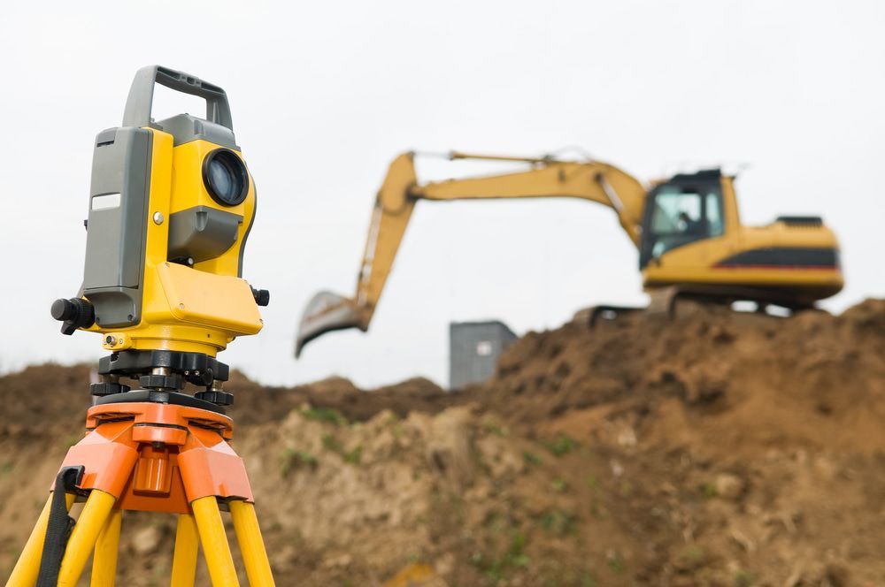
Equipped with state-of-the-art Trimble RTK GPS and GNSS technology, fully robotic S8 Total Stations and UAV surveying capabilities, we provide comprehensive solutions tailored to your needs. From defining property boundaries to delivering precise data for large scale developments, we ensure every measurement is taken with precision.
Whether you’re subdividing land, planning a build or need reliable site analysis, our team is ready to assist. Speak to our experienced surveyors in Gloucester today—call (02) 6558 2255. We service throughout Gloucester and surrounding areas including Taree, Harrington, Old Bar, Diamond Beach, Bulahdelah, Nabiac, Forster, Wingham, Dungog, Hawks Nest, Walcha and Stroud.

Services
Understanding the lay of the land is essential for property owners, developers and local councils. We provide detailed boundary surveys, topographic mapping and site analysis to support informed land use and legal compliance.
From early planning stages to final construction checks, we assist builders, architects and engineers with accurate construction set outs, as built surveys and elevation mapping to ensure projects meet design specifications.
Solutions for Every Industry
Surveying is more than marking boundaries—it’s about providing the data that drives informed decision making. CalCo Surveyors works with engineers, architects and construction businesses to deliver reliable measurements for developments of all sizes.
Whether you're overseeing a commercial project, need accurate set outs for construction or require drone assisted terrain mapping, we ensure precision at every stage. Our advanced surveying methods reduce delays, prevent costly errors and help projects progress smoothly.
We are committed to offering clients high-quality surveying services backed by technology and expertise. No matter the complexity of your site, we provide the insight needed for successful planning and execution.